
On-demand predictive wildfire simulations

Faster decision-making backed by up-to-date data
Reduce damage, save lives, and build a resilient future
LensVx equips users with precise forecasts, enabling the protection of critical infrastructure and homes. Mitigate risks effectively and create resilient, fire-resistant zones for a safer tomorrow.
Wildfire Data Needs To Be Faster Than The Flames

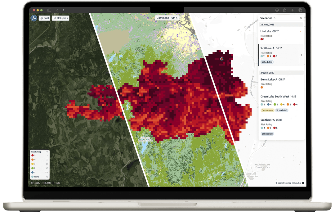
Clearly visualize & interact directly with the data
With modern data visualization you can rapidly zoom into areas of concern and turn data into decisions in a matter of seconds. Historic and current data can easily be compared to give further context.
No geospatial expertise required.
Identify problems on fast interactive graphs
Identify safe locations for future developments.
Compare and isolate various models
Determine which neighbourhoods are most vulnerable.
See trends by moving through timelines
Create data-backed response strategies.

Continuous risk assessment for your entire infrastructure
Define thousands of simulated ignition points across your entire operations. Adjust every aspect of simulation inputs and receive daily dynamic risk reports.
Book a demo to see LensVX in action
Stay ahead of evolving conditions
LensVx utilizes a detailed ensemble of weather models, allowing users to granularly view and adjust simulations. Stay ahead of evolving conditions and tailor strategies to specific scenarios with ease.
Faster access to weather forecasts and fire behaviour predictions
An Adaptable Fire Risk Solution for Every Sector
Request a Demo
See LensVx in action and discover how it can transform your wildfire risk strategy.
Book a Call